Fencing in Mildura: a city with a rural edge
If you are looking for fencing in Mildura, the first thing to settle is which side of the river your land is on. Mildura, Merbein, Nichols Point and Cardross are on the Victorian side of the Murray. That means Victorian boundary-fence law and Mildura Rural City Council apply to a fence there. Your enquiry is passed to a local contractor, who quotes and does the work. We refer; we do not build. For other fence types across the region, start from the home page.
The ABS counts a "Mildura and Buronga" urban area of 53,620 people at the 2021 Census, and that urban area spans the river. Buronga is in New South Wales, and a fence there follows the other state's rules, which are on the Buronga and Wentworth page.
What the 2021 Census shows
The figures below come from the ABS QuickStats pages. "Separate houses" is the share of occupied private dwellings that are separate houses.
| Area | People | Separate houses | Largest industries (share of jobs) |
|---|---|---|---|
| Mildura and Buronga urban area | 53,620 (median age 40, 23,731 private dwellings) | 84.8 per cent | Hospitals 4.0 per cent, supermarkets 3.3, grape growing 2.9 |
| Mildura North | 18,027 | 77.4 per cent | Hospitals and supermarkets lead |
| Mildura South | 16,408 | 84.3 per cent | Hospitals and supermarkets lead |
| Merbein | 2,770 (median age 44, 1,261 private dwellings) | 89.8 per cent | Supermarkets 4.8 per cent, grape growing 3.5 |
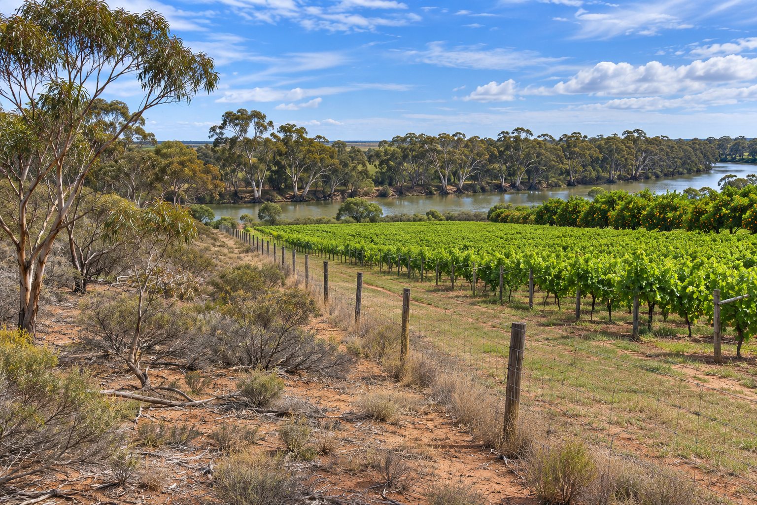
Mildura North has the lowest share of separate houses of any place on this site. The numbers cannot tell you how many homes stand on large blocks. The ABS pages give no lot sizes or rural-residential block counts, so any lifestyle-block reading is an inference. They do show that grape growing is a top-five industry across the urban area and in Merbein, so a fence at the edge of town may well run beside working vines. The vineyard and orchard boundary page covers gates, perimeters and channel edges.
Merbein, Nichols Point and Cardross
Merbein has its own census page, summarised in the table, and it is one of the places named in the irrigation channel works described further down. Nichols Point and Cardross are different. A secondary source, the Wikipedia page on the Rural City of Mildura, lists them as localities of the Rural City, and that is all we have. We did not fetch census figures for these two localities, so this page gives none and makes no claim about block sizes, crops or stock there. If your property is in either, the questions are the same as anywhere on the Victorian side of the Murray: boundary or internal fence, who the neighbour is, whether a channel or flood area is involved, and what the fence must hold.
Council, permits and boundary fences on the Victorian side
Mildura Rural City Council lists "sheds, carports, verandahs, garages, fences" among the building types that may need a permit, and says to check with its building department (see its building permits page). The council is on 03 5018 8100, at PO Box 105 Mildura VIC 3502, with service centres at 76 Deakin Avenue and 108 Madden Avenue in Mildura. We did not find Mildura's own height threshold for a fence permit, so we state none. Another Victorian council sets its trigger at a stated height (an illustration only), which is not Mildura's rule.
On the Victorian side of the Murray, neighbours usually share the cost of a sufficient dividing fence equally, and a neighbour has 30 days to respond to a Fencing Notice, according to Justice Victoria. The same page says the law "doesn't set a height or material" and that for rural properties a sufficient dividing fence "might be a wire and post fence". Bodies that manage public parks and reserves are not treated as owners, which matters where a reserve or State forest sits next to private land. An undated news item (Sunraysia Daily) describes boundary fencing along the Koorlong and Airport State Forest near Mildura. If your land adjoins public land, ask the land manager first. The notice steps are on the Victorian boundary fence page.
The river edge, flood overlays and the border
Mildura Rural City Council's page on Amendment C106mild says the Floodway Overlay and the Land Subject to Inundation Overlay in the Mildura Planning Scheme were updated using Mallee CMA flood mapping (council page). The page gives no date and does not mention fences. So we cannot say whether a fence on your block is affected. Ask the council's planning department, and see the Murray, floods and Crown land page for the permit points we could verify.
Victoria SES says the last significant riverine flood event was in 1956 and that flash flooding is the higher risk, citing February 2011, when 108 mm of rain fell in 4 hours.
On the border itself, two survey agencies inspected the river between the George Chaffey Bridge and the downstream weir at Mildura and agreed "the precise line of the border" in September 2022, with formal survey and marking still to follow (Land Victoria update). No source we found says what either state's boundary-fence law does for a fence along or across the river. If your boundary is the river itself, ask the regulator or a solicitor.
Irrigation channels at Mildura and Merbein
Lower Murray Water's Sunraysia Water Efficiency Project covers about 26.7 km of channel, with 16.0 km at Mildura and 7.0 km at Merbein (project overview). The works line channels and in some places replace them with buried pipelines, mostly in winter, and access arrangements are negotiated with landholders. The fact sheets say nothing about fences or channel reserve boundaries. That is a gap, so if your fence runs along a channel, ask Lower Murray Water before you ask for a quote.
What to send when you ask for a quote
Send the suburb or locality, a photo of the fence line, its rough length, who the neighbour is and what the fence must keep in or out. For a horse paddock or a small block, the horse and lifestyle block page covers wire, rail and electric options. For stock on larger land, see the farm and stock fencing page. Before you sign, read the licensing page, then send your details when you are ready.
What this page cannot tell you
It cannot tell you how many rural-residential blocks Nichols Point or Cardross has, because we found no census figures for them. It cannot say whether your fence needs a Mildura permit, whether a flood overlay applies to your block, or who is responsible for a channel reserve boundary. It also cannot say what either state's law does for a fence on the river itself. Ask the council, Lower Murray Water or the regulator for the current answer, and ask the contractor which licence or registration they hold.
Check the current rules before you rely on this
This page describes fencing around Mildura, Merbein, Nichols Point and Cardross on the Victorian side of the Murray, with the census, council, flood and irrigation facts we could verify. It describes the rules in general terms as they stood in November 2026. Standards, forms, thresholds and fines change.
The authoritative sources are Mildura Rural City Council, building permits, Mildura Rural City Council, Amendment C106mild: Mallee CMA flood mapping update, Justice Victoria, fences: your rights and obligations and Lower Murray Water, Sunraysia Water Efficiency Project overview fact sheet (May 2023). Where anything here differs from those sources, they are right and we are not.
We are not fencing contractors, builders, regulators or lawyers. For a Victorian boundary fence, start with Justice Victoria, the Dispute Settlement Centre Victoria and Legal Aid Victoria. For permits, ask Mildura Rural City Council on 03 5018 8100. For the contractor, ask which licence or registration they hold and check it with the Building and Plumbing Commission.
Accurate at the time of writing, November 2026. Always check the source before relying on it.